
Leave Your Message
Deploying heavy-lift, high-precision unmanned aerial systems engineered to transform geospatial site surveying and earthwork inventory metrics.
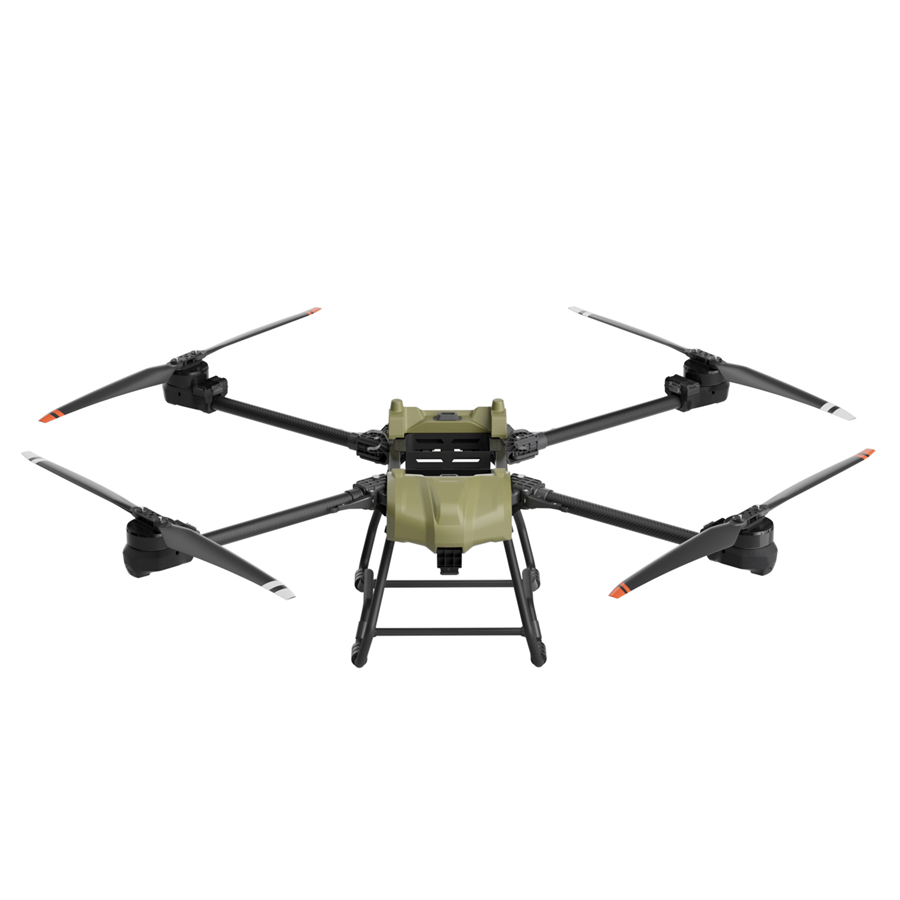
In the modern era of civil engineering, mining, and large-scale infrastructure development, accurate volumetric assessment stands as a cornerstone of project profitability, compliance, and logistical efficiency. Historically, estimating earthwork yields, stockpile volumes, and excavation progress was a labor-intensive, hazardous, and error-prone process. Surveyors relied heavily on manual techniques, including total stations, GNSS rovers, and physical measurements, which often took days or weeks to execute and put field personnel at risk in active construction zones.
Today, the integration of Construction UAVs (Unmanned Aerial Vehicles) has revolutionized this paradigm. By combining advanced aerial platforms with high-resolution imaging, LiDAR (Light Detection and Ranging), and RTK (Real-Time Kinematic) positioning, construction enterprises can now capture comprehensive site data in a fraction of the time. The raw data is processed using specialized photogrammetry software to generate dense 3D point clouds, Digital Elevation Models (DEMs), and orthomosaics, enabling precise volumetric yield estimation with millimeter-level accuracy.
Key Industry Shift: The transition from traditional land surveying to drone-based volumetric analytics has reduced data acquisition times by up to 80% while simultaneously increasing data density by thousands of points per square meter.
The commercial demand for construction-grade drones is experiencing exponential growth. Infrastructure developers, mining corporations, and earthwork contractors face tight margins and strict regulatory timelines. Discrepancies in material delivery, inaccurate stockpile audits, and poorly tracked excavation phases can lead to massive cost overruns and legal disputes.
By implementing specialized UAVs like the QT-D50 Heavy-Lift Hexacopter, companies establish a single source of truth. Real-time yield monitoring allows project managers to reconcile subcontractor billing, verify the volume of imported fill material, and optimize the dispatch of haul trucks. This level of transparency is reshaping supply chain management in the global construction sector.
The utility of Construction UAVs extends far beyond simple aerial photography. When deployed systematically, they serve as the primary data-gathering engines for advanced spatial analytics. Let us explore the core application scenarios where drone-derived yield estimation drives substantial operational value:
In concrete manufacturing, road building, and quarrying, stockpiles of gravel, sand, asphalt, and raw minerals represent significant capital. Traditional methods of estimating these volumes are notoriously inaccurate due to irregular shapes and uneven terrain. UAVs equipped with high-resolution cameras fly pre-programmed grid patterns, capturing overlapping images from multiple angles. Photogrammetry algorithms reconstruct the stockpiles in 3D, calculating the volume of each pile relative to the base terrain. This enables weekly or even daily inventory audits without disrupting active site operations.
Before any structure can be built, the site must be graded. Cut-and-fill analysis determines the volume of earth that needs to be excavated (cut) and the volume of soil required to elevate low areas (fill). By comparing a drone-derived 3D mesh against the project's digital design file (BIM model), engineers can visualize exactly how much material has been moved and how much remains. This prevents the costly mistake of over-excavating or importing unnecessary fill dirt.
In extractive industries, yield estimation translates directly to revenue forecasting. Construction UAVs facilitate rapid mapping of quarry benches and pit walls. By comparing sequential drone flights, operators can determine the exact volume of rock extracted over a specific period. Furthermore, this data helps monitor structural stability, identify potential landslide risks, and plan future blasting operations safely.
Modern construction management relies on tracking progress against the master schedule. Aerial data provides visual and quantitative proof of work completed. If a contractor claims to have excavated 10,000 cubic meters of earth, a quick UAV flight can verify the exact volume within hours. This reduces payment disputes, enhances collaboration, and keeps complex projects on schedule.
We believe the sky is not a limit — it's the next frontier for everyday mobility. At Anhui DaShu Aviation, we're on a mission to make aerial services accessible to everyone. Whether it's helping farmers protect their crops more efficiently, delivering heavy cargo to hard-to-reach areas, or reimagining how people and goods move across cities — we're building the aircraft that will take you there.
Our vision is to construct a smarter, safer, and more reliable ecosystem for intelligent three-dimensional mobility. We promise simpler technology, safer flights, and more dependable experiences — because the future of flight shouldn't be complicated or out of reach.
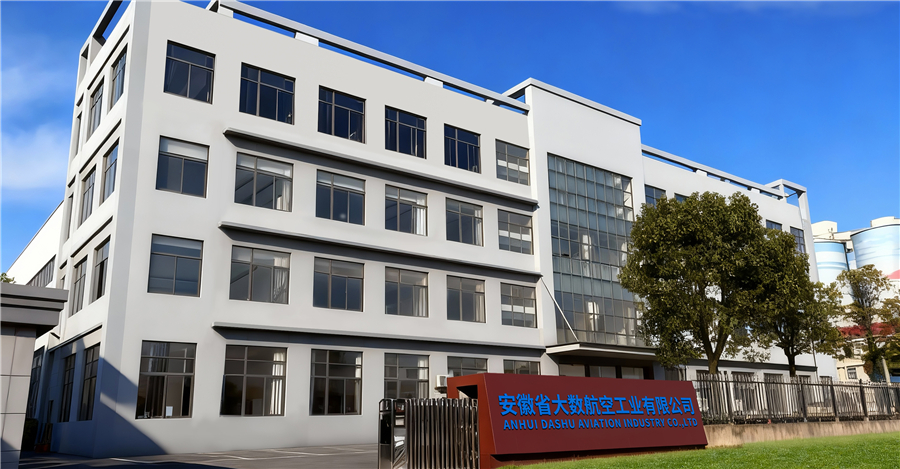



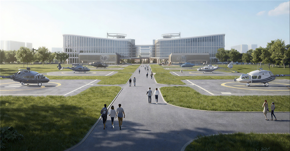
From safeguarding harvests to moving what matters most, our UAV solutions are built to fit seamlessly into your life and work, no matter the mission.

The future of urban air mobility. Efficient, and completely emission-free, our eVTOL aircraft are designed for passenger transport and city logistics. They can decongest crowded roads, reduce travel times, and lower carbon footprints — making daily commutes faster and cleaner for everyone.

Precision crop protection that saves time, reduces waste, and significantly improves yields. Our drones navigate complex farmland with ease, automatically avoiding obstacles while applying fertilizers and pesticides exactly where needed. This keeps farmers safe from chemical exposure, lowers operational costs, and supports sustainable farming practices.

Reliable logistics solutions for last-mile delivery, emergency supply transport, and industrial operations. Whether it's delivering medical supplies to remote villages, transporting construction materials to mountain sites, or supporting disaster relief efforts, our drones carry heavy payloads over challenging terrain with minimal human intervention.
As technology progresses, the integration of artificial intelligence (AI) and edge computing will further refine the efficiency of drone-based volumetric surveys. Here are the key trends that will shape the industry in the coming years:
One of the current bottlenecks in photogrammetry is data cleaning. Raw point clouds often capture unwanted objects like machinery, vehicles, vegetation, and personnel. Advanced AI algorithms are now being developed to automatically recognize and filter out these non-terrain elements, generating clean digital terrain models (DTM) with minimal manual intervention. This dramatically accelerates the turnaround time for volumetric reports.
To achieve continuous site monitoring, companies are moving toward automated, scheduled drone flights. Drone-in-a-Box solutions allow a UAV to automatically deploy, fly a pre-programmed mapping route, land back in its dock, recharge, and upload the captured data directly to the cloud for processing. This provides site managers with near-real-time updates on yield changes and earthwork progress without requiring an on-site pilot.
While photogrammetry is highly effective in clear sightlines, LiDAR is essential for mapping terrains with dense vegetation. Future construction drones will increasingly utilize hybrid payloads that combine high-resolution RGB cameras with lightweight, cost-effective LiDAR sensors. This allows for simultaneous visual mapping and structural penetration, providing highly accurate yield estimation regardless of ground cover.
The digitization of the construction site has led to the rise of unified cloud platforms. Drone-derived 3D models are uploaded directly to the cloud, where stakeholders—from project managers on-site to executives at headquarters—can interact with the model, perform measurements, and review volumetric yield reports in real-time. This level of accessibility fosters collaborative decision-making and accelerates project timelines.

Explore our complete catalog of industrial-grade heavy-lift hexacopters, designed for transportation, emergency response, and precision geospatial mapping.